Thanks for the explanations!
The shader certainly does make the island look like it's covered by trees.
I'll investigate HF2, but PNG seems to be the best choice for me for right now.
Thanks, again.


Thanks for the explanations!
The shader certainly does make the island look like it's covered by trees.
I'll investigate HF2, but PNG seems to be the best choice for me for right now.
Thanks, again.
Selden
Heres the greyscale height map (above sea level).
http://www.viewing.ltd.uk/Temp/CG/Th...gray_4kx2k.png
Thanks!
It looks like it does not include the subsea elevations. Is that right?
Is a version available which includes the full extent of the heights?
I realize that its resolution in altitude would be quite a bit lower.
ImageMagick's identify utility reports that it's an 8bit grey-scale image. Is a 16 bit version possible? That would help with the vertical resolution, I think.
Sorry to be such a pest. Your help is greatly appreciated.
Selden
I thought the link above had that stuff in them. These were supposed to be the original world maps used. Your probably best off using these as they have the highest res of them all.
http://www.cartographersguild.com/sh...&postcount=105
Actually I think someone must have asked about this before as I have a PNG16 sat on my drive here. I dont use these so I cant think why I have it otherwise.
Anyway, DONT CLICK on the link below. Right click and save as to your HDD. Its rather big.
http://www.viewing.ltd.uk/Temp/CG/Th...orld_png16.png
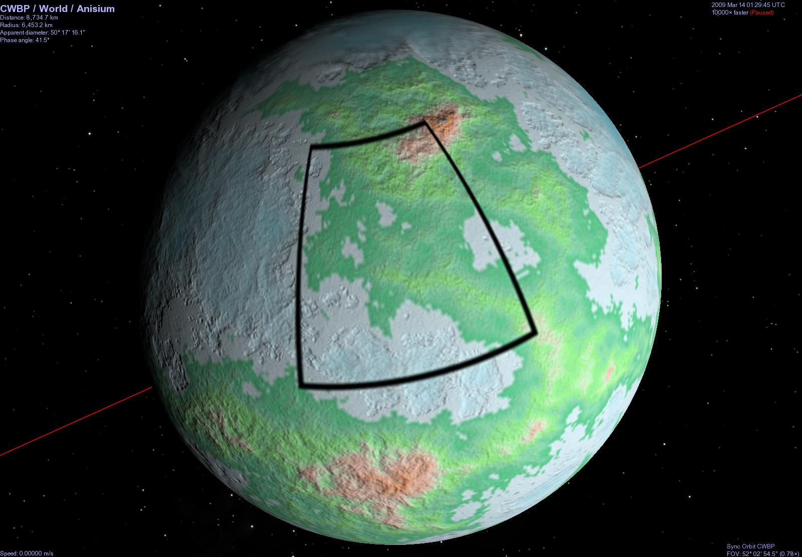
Unfortunately, world4-grey is a square bumpmap which seems to be only for the region currently being mapped by Guild members, not of the whole planet.
The other zip file contains World4.ftw. I don't have Fractal Terrain. Is there a converter available for the .ftw file format? L3DT [which I just downloaded] doesn't recognize it, and it isn't listed on its plugin Web page.
Selden
Thanks!
It's downloading now.
I found a free viewer for FT files on their web site.
I'll give it a try, too, once I get the email saying where to get it.
Selden
After some massaging, I managed to persuade world_png16.png to align with the zoom texture. When both are scaled to 2048x1024, there's an offset of about 100 pixels in longitude between them.
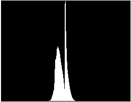
Note, however, how flat it is along the coastlines. ImageMagick's histogram facility revealed that there aren't very many levels in the heightmap. It'd be nice if that could be improved.

Selden
What does that histogram analysis look like on an Earth-derived heightmap?
Whilst it looks bad on the histo, it is supposed to be a 16 bit PNG so its a smallish section of 65K levels instead of 256. If this were a small bit of terrain and we were going in for a 3D through the mountains look then it might matter but wrapped on a planet then I think its going to make no visual difference at all.
Although I cant remember doing the PNG16, I would have thought that I derived it from the HF2 map so that my color and the height should have lined up. Neither might line up with the original FTPro color map or zoom map tho. If you wanted to align them then you might have to work it a bit.
Its likely to be flatish at the edges of the land mass because it would normally be something like that and FTPro has some sort of subsea flat land region before it starts to drop off steep subsea. Note my amazing lack of geological terminology there. It does mean of course that any slight Z offsetting does produce quite a radical sea-land shape from the height maps.
 Posting Permissions

 Reply With Quote