Page 3 of 3 FirstFirst 123
Results 21 to 24 of 24

Thread: Satellite Style Mapping for Ultra Realism

  1. #21
    Guild Expert johnvanvliet's Avatar
    Join Date
    Jul 2012
    Location
    N 42.39 W 83.44
    Posts
    1,091
    Blog Entries
    4

    Default

    they are ?? iff-y?? there on the "way - back - machine
    "http://web.archive.org/web/20131006025720/http://www.shatters.net/forum/viewforum.php?f=21&sid=842177c8ba9c1aacee005aac472 46e63

    some still have a capture like:
    shatters.net ? View topic - (#1)The guides on "making planets"
    --and
    shatters.net ? View topic - (#11) making a planet -Wilbur
    and
    shatters.net ? View topic - (#12) fixing a image & making a HeightMap


    Now a bit of caution
    I was posting those in response to a few people trying to have addons for celestia that were NOT !!!! maps that could map to a sphere
    ( i was a bit "****-ed" off at the time )

    the image in the first post is a good start , not too bad for a first/early start

    wrapping ones head around "warping" a image to MAP to a sphere -- takes some time
    and a "photo realistic" also takes time to learn to do well

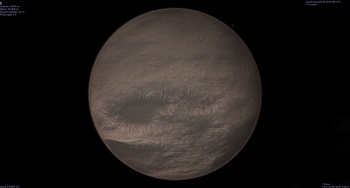
    some examples of "Exo-Planets" i have done

    Gliese 832 C

    a 8bit copy of the 32 bit DEM and 2 screenshots of the Normal Map only


    A hot "Super-Venus"
    with and without clouds
    I likely will be changing the ground texture


    Kepler-186-F


    there is no real
    step #1
    Step #2
    Step #3
    -- and so on

    70% to 90% of every map i start i DELETE before finishing it
    -- normally they just DO NOT LOOK RIGHT -- as in "Something" is just " off" with them

    Start with a Height map ( aka DEM) a "Digital elevation model "
    then is it a "earth" type ? yes / no ?
    if so then decide on what is water and land
    then go from there
    Last edited by johnvanvliet; 11-06-2014 at 10:23 PM.

  2. #22

    Default

    Quote Originally Posted by ElighaN View Post
    I do, my computer is to laggy to handle the 3d tools for long, but my problem is once I make the 3d edits how do I turn that image back to the normal 2d map for those finer edits?
    It took a little bit of hunting, but I figured out how to do that. I'm looking at Photoshop CC, so the controls may be slightly different. With your 3d layer selected, there should be a Properties window that shows the settings of your material. Assuming you haven't done any other editing, only the Diffuse channel should have a map in it, as indicated by a layer icon instead of a folder icon to the right of the swatch. If you click that icon, you should get a pop-up box. The top line is "Edit texture..." Clicking that should open another Photoshop document with your original map layer stretched back out as it was when you applied it. However, it will probably have a weird triangular grid over it. That's the layout of the polygons making up the sphere. You should again have a Properties window for 3d Paint. If you unclick "UV Overlays" that grid will go away.

    Again, I'm not terribly familiar with Photoshop's 3d system, and I have no idea how it's changed as the program's been updated, but hopefully that gets you pointed in the right direction.
    Bryan Ray, visual effects artist
    http://www.bryanray.name

  3. #23
    Guild Expert johnvanvliet's Avatar
    Join Date
    Jul 2012
    Location
    N 42.39 W 83.44
    Posts
    1,091
    Blog Entries
    4

    Default

    I am trying to make a spinning globe and have a moon spin around it as well. I'd like to maybe animate the stars too, but that is a after thought.
    The program "celestia" is good for that
    i would recommend building the source code from SVN
    that is really version 1.7
    and not the ancient 1.6.1


    as has been pointed out
    the image "ImageUploadedByTapatalk1410817827.067176.jpg" dose NOT map to a sphere


    now looking at it it looks like you used a perlain noise and used a option to "Tile" it

    that is good for the east/west boundary
    I use a 180 Degree Positive East labeling
    --- 90 north ---
    -180 to +180
    --- 90 south ---

    Also i use ALL opensource and LINUX programs

    well the poles ARE fixable and the "Mercator" look is also fixable to make it look right in "Simple Cylindrical"


    your map looks like a simple resize would be ok for this

    Using "The Gimp" i removed the grid ( resynthesizer )
    resized to 1025x 512
    used the "/distort / polar coordinates " and resynthesizer to fix the poles

    and i get this


    this will map to a sphere
    the 180 and +180 east/west boundary MATCH and the poles will compress around a sphere

  4. #24

    Default Satellite Style Mapping for Ultra Realism

    Thank you or your help! I appreciate it!

Page 3 of 3 FirstFirst 123

Posting Permissions

  • You may not post new threads
  • You may not post replies
  • You may not post attachments
  • You may not edit your posts
  •