Reply With Quote
Wow, very nice job!
I especially love the fields (pastures and crops)! Did you make a texture and the hedgelines yourself for those?


Hello there,
This map is part of a series of locations i'm inventing/detailing for my Pathfinder campaign, I've used the existing country of Brevoy (from the campaign setting "Golarion, the inner sea") as a starting point since it isn't very detailed by Paizo yet, and i'm having fun coming up with the details.
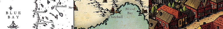
Fière-Muraille (literally "Proud Rampart/wall") is located in the middle of the fertile Rostland Plains, it's a very old town with a lot of history. Mostly, It was often used by Rostland as a last line of defense before enemy forces could reach southern towns and Rostland's capital : Restov.
The whole place has a lot of little stories and details, and it all ties into my campaign, unfortunately it's all in french so most of you won't be able to read the labels.
Digitally hand-drawn in Photoshop, 3230x3100 pixels, a ton of fun to imagine, conceptualize and make.
Hope you enjoy!

Wow, very nice job!
I especially love the fields (pastures and crops)! Did you make a texture and the hedgelines yourself for those?
This map is so warm and inviting, makes me want to explore it straight away! Don't think I commented earlier on, but I really enjoyed following your WIP. Great work!
Cheers,
Tainotim
You did such a great job on this Narolas.
The fields look great, especially with the trees along the edges.
The pavers fit well and are nicely blended into the dirt further to the edge.
The colors are nice too. All around fine work.
Artstation - | - Buy Me a Kofi
Excellent work, REP time!
My Battlemaps Gallery http://www.cartographersguild.com/al...p?albumid=3407
Thanks for the (quick) feedback!
The "depth" of the fields is hand-drawn each time by slightly making it brighter/darker, there's a big assembly of layers on top of those (with subtle textures) to make it look nice, the trees/bushes on field borders are a simple fuzzy kind of brush with a depth + texture FX on the layer, the field borders themselves are a combination of a black clean line and a gray fuzzy line with texture + depth FX layer.
I spend a ridiculous amount of time planning and making those fields, even researched medieval farming to make it sorta accurately, so i'm glad it's paid off
Fine work, the overall map is great! The less convincing elements are the forests in my opinion.


Nice Job Narolas, I know you've been on this for a while, it was well worth it. Not fond of the type choice, especially on the map itself, but otherwise great job. Have some reps!
Great map, and I enjoyed watching it come together.
"We are the music makers, and we are the dreamers of dreams"
Great concept, interesting WIP, and a very beautiful result Narolas! I love how you did the crops.
 Posting Permissions