Reply With Quote
Looks good Ilanthar, I always like maps projected this way, and the colours are really great, I also like the shaded relief you've got started, really nice. I'm excited to see this develop, I'm really liking the style so far.

I'm still working (a bit) on my others WIP (believe me!), but in the same time, I was really tempted to do again a map similar to my old "elzevir geopolitics".
I also thinking about doing some worldbuilding stuff for fun on this one... Don't know yet...
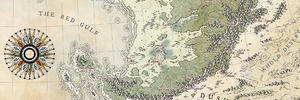
After a lots of trials, I decided for this land shapes. I'm still wondering if I should use this Natural Earth Projection or not... I'm using G Projector if you think there's a better one for a world map.
Please note that I will redo properly the coastlines and the coasts. And of course, it's just a very first test about topography and colors. Anyway, let me know what you think!
PS : maybe I sould do a workshop. pfff, so many unfinished works (5-6 at least, I believe), in so many different threads...
Looks good Ilanthar, I always like maps projected this way, and the colours are really great, I also like the shaded relief you've got started, really nice. I'm excited to see this develop, I'm really liking the style so far.


fLIPING AWESOME!
Do not worry about unfinished maps, it just means more Ilanthar maps for us


Ohhhhh yeah, another Ilanthar map for me to drool over!
Cool, always good to see another Ilanthar WIP!
I already am in love with the landshape compositionI am not so sure if i like the projection. I'd vote for a classical map-view (like some of the others you did, for example still a big fan of your Domhantyr map...btw i hope you'll do another map in that style sometimes!).
Looking forward to more!
I'm trapped in Darkness,
Still I reach out for the Stars
Thanks everyone!
I realized I did the waters a bit darker than on my Elzevir map. So a new version with the brighter sea (& with the dark, for comparison).
&
Which one do you prefer?
I redid the coastline. Still working the topo and colors... And I had to resize it a bit, loss of resolution... I'll post jpeg instead next time.
@Diamond ; don't drool on my maps, it's gonna leave water marks
Just sniped by Eilathen, thanks
Eilathen, that's how it looks in a "flat" mode (and so much lighter in jpeg).
Thanks for the view, I'm not sure of what I'll do for the world map. If I do regional maps, I surely choose an other projection (like azimuthal equidistant/equal area).
About Domhantyr, I've began a regional map... a long time ago
Last edited by Ilanthar; 10-27-2016 at 12:25 PM.
My only critique would be to morph the topograpy a bit more in certain areas as some are recognisable as earth bound locations.
Hey, Ilanthar, looks terrific so far. Must say, though, I do like the plain flat version better than the projectioned. Guess I'm just a cartographic conservative. Or something.
But the continental shapes look great, very convincing. The coloring is super, maybe it could stand to use a bit more variety, like more reads? Though the faded feel is cool too, so if you plan to keep it that way, go for it. The relief is flawless, looks very crisp and scaled just right. How did you achieve that? Are they from some resource or done with an effect in Photoshop?