Reply With Quote


Thanks SapientoBy Sapiento
Did you create the symbols on the flags yourself or were you using some resources?. I created a few, rearranged or modified some other and took the rest from different sources (some free icons, mostly).
Thanks THWBy THW
As others have said before, this looks amazing. Well done.
Thanks EilathenBy Eilathen
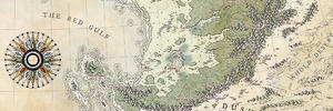
Love it, Ilanthar! Especially the landshapes (i was trying to come up with something alternate-earth-y but this is just...as close to perfect as it gets)..
And since a lot of you are appreciating the flags, here is a flag book where they are only half their original size (in the first post).