


a synesthetic heightmap from image
" easier said then done "
-----------------
first the disclaimer
there is NO "great" or "set" way to convert a image into a heightmap !
second
EVERY image is going to be a bit different !
and depending on the starting point different ways / tools can be used
a black and white copy of a SHADED RELIEF MAP IS NOT !!! a HeightMap
heightmaps are the Z axis in a x,y,z 3d coordinates
in this case the distance away from the center of a planet
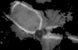
this is from a question i was asked
how to convert this painted map ,using copy/past and the clone tool and painting into a HeightMap
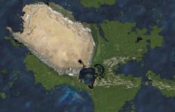
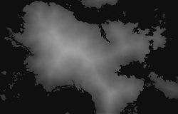

first thing is LOOK and i mean really look at the image
because you will need to make masks ( i used to do this in the photo Darkroom and using a computer is WAY!!!! easier )
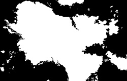
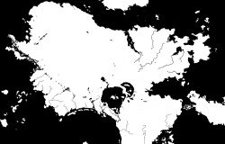
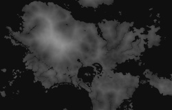
first one is a ocean & lakes mask
the second is the WATER mask ( ocean .lakes, and RIVERS )
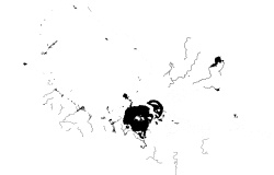
then a mask for just mountains
and if needed one for just low rolling hills
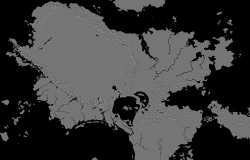
the more masks and using small areas the better the quality and MORE TIME needed so for this i am using just the basics
and all FREE GPL'ed software that can be used on ( or free and using WINE)
Linux
Apple
And
Microsoft Windows
Gimp and the G'Mic plugin
gimp 2.8.4 will make a 8bit heightmap
Gimp 2.9.4 DEVELOPMENT ( will be gimp 2.10) can make a 16 or 32 bit heightmap
and the plugin for Gmic
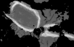
" select by color" is a great tool for SOME images
both "connected area" and "all image" tools can be used
for others the gmic plugin tool "Repair / Local similarity mask" can be used
other useful tools are the Gmic
"Contours / Curvature"
"Contours / Distance Transform"
"Contours / Isophotes "
you need to get clues from the image in question
for this one the desert area in the mountain ring looks to be a bit higher than the land around it
and most of the rivers are LIGHT brown for a mask these need to be darker than the green area
making masks can take some time

 Reply With Quote