Reply With Quote
The mountains drawn with soft touch are good!
By having a flatland between the mountain and the mountain, I think your map will become more real.
The end of the mountain becomes a cape or peninsula.


So, I've started a new project for a world that I want to use for my writing and possibly roleplaying. I just found this forum and I must say that you guys have inspired me so much to go way more scientific than I was planning onHowever I will probably not go all the way with that, I also really want to start writing at some point haha...
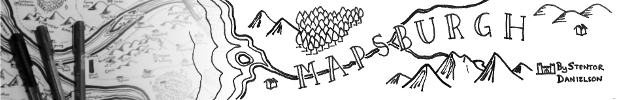
With that being said I would love to get some comments on my work along the way! This is the map of all the land masses of the world, though there might be more water and ice outside the boundaries of the paper. I'm also using this project as a way to learn how to draw better so please be gentle about the drawing itself (though tips are welcome!).
I've also drawn up my idea of the tectonic plates. What do you think of those? Any general thought of how the climates would be affected? For example the big mountains on the eastern continent will probably impact the climates on the north and south side of it pretty much.

The mountains drawn with soft touch are good!
By having a flatland between the mountain and the mountain, I think your map will become more real.
The end of the mountain becomes a cape or peninsula.

It's hard to say what the climate effects will be without knowing what latitude your map covers. Where are the equator and poles located? In general, I'd say the two mountain ranges in the northwest are likely to have larger climate impacts than the ones in the east or south, because they stand to block easterly or westerly prevailing winds.
Thanks! I'm actually really proud of how the mountains turned out since this is my first time trying something other than just small ^ shapes. However what do you mean by between the mountain and the mountain? Which mountains?Originally Posted by qhqhTerra

Thanks for you reply! I'm still very new to this so there's a lot I don't think of... The map is supposed to pretty much cover all liveable land, with a north pole stretching up from the northern continent and the south pole somewhere below the southern continent. I also haven't exactly decided how much water is between the continents the other way around if that makes sense. But the equator is somewhere around here:
Would you mind expanding on the northern mountain range having more impact on the climate? Or maybe just link to somewhere I could read about it?
Thanks for taking your time replying!
 Posting Permissions