Page 7 of 12 FirstFirst ... 34567891011 ... LastLast
Results 61 to 70 of 114

Thread: Hand drawn maps

  1. #61
    Guild Expert Facebook Connected Caenwyr's Avatar
    Join Date
    Apr 2012
    Location
    Flanders, Belgium
    Posts
    1,276

    Default

    Quote Originally Posted by Impractical Cartographer View Post
    I'm not a watercolorist. I use watercolors to a very limited purposes to colour or shade something. I had a problem with the fact that even small amounts of water deformed my favorite paper. So I started experimenting. I thought: if the alcohol markers don't deform my paper, maybe I should try adding alcohol to the paints. And that's how it started
    It started like most alcohol themed experiments then: "what if I just try it and see what happens!"
    Caenwyr Cartography


    Check out my portfolio!

  2. #62
    Professional Artist ThomasR's Avatar
    Join Date
    Nov 2015
    Location
    Angers, France
    Posts
    4,153

    Default

    My chemical two cents :

    From what I know, bright colors are often what we call chemical complex : ions combined to other molecules (often water) to change the interaction of the substance with light. Swapping water for alcohol has a chance (risk ?) to alter the color. Using solvents like ammonia or acetone might have an altering effect too. One could easily play with a palette and see the results (but it's gonna be smelly). An issue : how would the paper react to acids and bases ? Also, alcohol, even if it's evaporating for the most part will remain in small doses and will eventually get oxidized into organic acids and that might change the color with time, air and light exposure or weaken the fabric of the paper.

    Teacher Tom out

    PS : on a personal note, I love all the ideas expressed here and might try some if I find the time

  3. #63

    Default

    I need to try that.
    Lots of good info in this thread

  4. #64

    Default

    Yes, this is a good discussion for me to file away for later...

    I'm loving your tree work!

  5. #65
    Guild Journeyer Impractical Cartographer's Avatar
    Join Date
    Dec 2019
    Location
    Gdynia, Poland
    Posts
    180

    Default

    Little change of subject.

    Labeling and layering in hand-drawn maps.
    Perhaps many of you will consider it a trivial issue. But it was very difficult for me.
    Then I learned the basics of calligraphy and... it was still difficult.
    On digital maps, it was simple - the text was the last layer.
    While drawing I had to completely reverse the arrangement of layers.

    Click image for larger version. 

Name:	layers1.jpg 
Views:	68 
Size:	88.0 KB 
ID:	120042

    By trial and error method I discovered the correct order of drawing.
    1. Towns icons and names.
    2. Main labels - names of countries, geographical areas, mountains, etc.
    3. Rivers.
    4. Coastline.
    5. Legend and description of the map.
    6. And when it's all written down, I start drawing the rest. An additional reason is that most mistakes can be made with calligraphy - typos, misspelling, ink blobs - so when I start drawing I prefer get this risk of over with .
    7. The roads at the end.

    Click image for larger version. 

Name:	layers2.jpg 
Views:	82 
Size:	100.5 KB 
ID:	120044

    Click image for larger version. 

Name:	layers3.jpg 
Views:	70 
Size:	374.7 KB 
ID:	120045

    And how do you arrange layers on your maps? Can you give me a hint? Share your mistakes?

  6. #66

    Default

    I usually lightly pencil in the geography, then pencil in the lettering to get a sense of label sizes. After that, I'm not so careful about order of operations when I add the ink - but then, if I added borders around the lettering or I was doing calligraphy, I probably would put the labels down first.

    Typically, though, I end up doing coastline, then mountains, then rivers, then forests. That's because I tend to do the fine placement of features organically, so where the mountains are determines where the rivers flow, then where the water is suggests where the trees go, and so on. I do have exceptions for things like mountains drawn in perspective obscuring the shoreline.

    Your pencil-shaded relief mountains are awesome.

  7. #67
    Guild Journeyer Impractical Cartographer's Avatar
    Join Date
    Dec 2019
    Location
    Gdynia, Poland
    Posts
    180

    Default

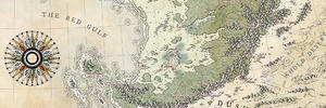
    Meanwhile... I just got a scan.
    The map of Middle-earth that I drew for my niece as a Christmas present.

    Click image for larger version. 

Name:	middle-earth2.jpg 
Views:	91 
Size:	4.02 MB 
ID:	120066

    Ink, colored pencils & pastels.

  8. #68
    Guild Journeyer Impractical Cartographer's Avatar
    Join Date
    Dec 2019
    Location
    Gdynia, Poland
    Posts
    180

    Default

    In the meantime, I'm breathless...


    My Facebook's fan took a scan of my map and made a video he sent me as a gift.

    I don't know what to write. Wow!

  9. #69
    Guild Expert Facebook Connected Caenwyr's Avatar
    Join Date
    Apr 2012
    Location
    Flanders, Belgium
    Posts
    1,276

    Default

    Woah man, that's fantastic. And they did a great job with it too!

    But let's face it, they would never have done this if it weren't for your magnificent ME map, which is an absolute piece of art. My hat off to you sir!

    Sent from my SM-A705FN using Tapatalk
    Caenwyr Cartography


    Check out my portfolio!

  10. #70

Page 7 of 12 FirstFirst ... 34567891011 ... LastLast

Tags for this Thread

Posting Permissions

  • You may not post new threads
  • You may not post replies
  • You may not post attachments
  • You may not edit your posts
  •