Page 10 of 11 FirstFirst ... 67891011 LastLast
Results 91 to 100 of 107

Thread: Errispa

  1. #91

    Default

    Nice! I'm looking forward to see your next steps on this, Mouse.

  2. #92

    Default

    Thanks Ilanthar

    I think this is going to be the map that I end up re-starting a record number of times.

    Here is yet another version of the same thing - this time I'm working on a much larger map (18000 x 9000), despite Win 10 and a really tiny laptop.

    This is about 1/4 size, and uses 3 layers. The background is the lighted greyscale image from Wilbur merged with a bit of very smooth parchment, the top is the sea mask I haven't painted yet, and the middle layer is the Grain Merge layer on which I'm painting the colours (which are very unrealistic - but then so is the scale, considering this is an Earth sized planet)

    Ver 4.jpg

  3. #93
    Guild Expert
    Join Date
    Jan 2016
    Location
    Canada
    Posts
    1,499

    Default

    I really like the land shapes Mouse, I wish I could come up with something like this for my own world map, will you be doing regional sections as well?

  4. #94

    Default

    Thanks Kacey

    This is a heavily modified Fractal Terrains 3 world, so the credit must go to Waldronate in large part for writing the app - for that and Wilbur, where I eroded the rivers.

    It would have been more realistic in scale (the mountains and rivers would have been half the size they are) if I had a bigger computer to munch through the processing to be able to use a file more like 25,000 - 30,000 pi in width but I make do with what I've got

    For the first book I only need a basic map of Errispa, since all the action takes place on Ethran - its twin. Errispa is simply present in the sky at all times, and is the goal of my protagonists hearts.

    I will certainly end up doing at least 3 regional maps for the second and third books, though, and maybe two more for the fourth. I'm hoping that by then I will be able to draw a half reasonable regional map

    Anyway... I don't think there is anything wrong with your land shapes. I like them

  5. #95
    Professional Artist ThomasR's Avatar
    Join Date
    Nov 2015
    Location
    Angers, France
    Posts
    4,153

    Default

    Impressive work Sue ! And I love this big desertic bassin that turn into a fertile plain !

  6. #96

    Default

    Well, I've smoothed the terrain a bit so that there are a slightly more realistic number of mountains in this world. And I've enlarged the virtual size of the map to 24000 x 12000 pi, even though I can't work on that size on my laptop. I've cut it into 3 continental maps (same projection) just to be able to work on them.

    This is the first real colour test (20% full size)

    ARANJOVAR colour test.jpg

    This is the continent of Aranjovar. I've only really worked on the top half just yet, so ignore anything below the equator. The colours aren't meant to be a satellite image, though they were inspired by the many coloured versions of the Earth as seen from space.

  7. #97

    Default

    Oh Thomas! I didn't see your reply while I was busy making my own comment.

    Thank you very much

    I've done the colour test on a different continent this time. Sadly I think I've altered the geography of the one you were talking about, but I will see what I can do to give it a similar feel to the way it was before

  8. #98

    Default

    Wow! That's a lot of work in a short time! Is the darker green forests?

  9. #99

    Default

    Thanks MMM

    At this scale (the 'look at it from outer space' type of scale), the darker green could well be forest - particularly in the northern latitudes. I expect those are dense forests of pine, untouched by man as yet because there were no men on Errispa when this map was made

    All I'm doing with this map is creating something I can stare at and work out whether it is reasonable for character A to drop in on character B later that afternoon. I mean, the were-hawks might fly 2-400 miles in a day, but if there are at least 1000 miles between them the story starts to not make much sense, as I'm sure most readers have a far better memory than I do

    It might sound a bit crazy, but until I have it all mapped out in general like this the geography of Errispa remains maddeningly flexible in my imagination, such that I have to really think about where things are before I write the next chapter.

  10. #100

    Default

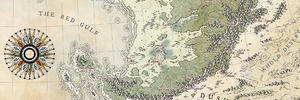
    More progress.

    It took me 6 hours and 3 crashed files, but I've managed to stick all three continents back together so I can work on them all at the same time. They are all at different stages of development right now, but things will improve quite quickly from here on in.

    When I've got this standard equirectangular map sorted out, I'll do a version in the previous style so that I can finish the border work.

    Ver 5.jpg

    And I'm still trying to work out how my laptop managed to hold the 18000 x 9000 pi file together even for a few minutes, when I know there should only have been 6GB of RAM and swap in total (allowing for the 2GB that Win 10 swallows). The GIMP memory indicator at the bottom of the screen was saying 10.2 GB.

    Weird stuff happens...

    However, no more crashing now. I've reduced the master file to 4 layers at 12000 x 6000, which seems to be working nicely at about 3GB.

Page 10 of 11 FirstFirst ... 67891011 LastLast

Posting Permissions

  • You may not post new threads
  • You may not post replies
  • You may not post attachments
  • You may not edit your posts
  •