Page 1 of 2 12 LastLast
Results 1 to 10 of 15

Thread: Great Lakes Earth

  1. #1

    Info Great Lakes Earth

    From Space[/SIZE]

    Back home, the moon has a diameter of 2159 miles and orbits Earth from a distance of 240,000 miles. You would need 81 moons to match the mass of Earth, and six of them to match its gravity. The moon that orbits Great Lakes Earth is far larger—3200 miles in diameter. It’s also a little farther from the parent, orbiting from a distance of 250,000 miles. This would mean a brighter nightscape than our own—almost twice as bright. Despite these differences, the mass and gravity are identical to those of our moon.

    The four gas giants are still there and still noticeable. However, in regards to size, each has a greater diameter by 1.3 and twice as much mass. This would mean a substantial increase in gravity. If this happens to Saturn, the rings that make it popular would be larger, maybe, but more solid and more compressed due to its higher gravity. These differences are so overwhelming that they directly affect the asteroid belt that divides the rocky inner planets from the gaseous outer planets. Whereas ours is a thick doughnut of fragments of rock and metal, the asteroid belt that haunts the system of Great Lakes Earth is as thin as an astronomical wedding ring.

    The only gas giant with a name identical to ours is Neptune. Jupiter is named “Jove” in Great Lakes Earth, Saturn “Kronos” and Uranus pronounced “Ouranos”.


    Oceans

    Comparing Great Lakes Earth to ours, we’d find that all land below sea level has become water, and Death Valley, the continent’s lowest and hottest point, is no exception. In its place is Lake Manly, a long but narrow strip of water fed by rivers flowing from Bidahochi.

    It’s interesting that if we see the West Coast of Great Lakes North America, we’d see a real different shape. While the Atlantic coastline is similar to ours, the Pacific coastline looks as though 75 meters of sea level have risen.

    In the place of the original Cascades is the Sea of Missoula. Using the flood basalts of the Columbia River as a reference, we’d get a good idea on the shape, area size and location of the Sea of Missoula.

    Physically absent in the supercontinent are Turkey, Israel, Iran, and the Low Countries (Belgium, Netherlands, Luxemburg and Denmark). Back home, Scandinavia is one of Earth’s reconginzable peninsulas. On Great Lakes Earth, the body we’d recognize as the Baltic Sea is dry land.

    Eurasia is subject to Great Lakes Earth’s largest sea, one that we used to have back home—the Tethys. For a clear picture of the extent of the Tethys, we must imagine the entire southern coastline of Europe as though 75 meters of sea level have risen. We must also imagine all land below sea level being water, which means that the Caspian Depression is completely flooded.

    In Asia, what looks to us like Borneo is a big extension of eastern India, erasing the Bay of Bengal from the map. Sumatra is an extension of India’s western coast. The rest of Indonesia, as well as the island chain of the Phillipines, don’t exist. This leaves the Malay Peninsula dangling on its own.

    To the naked eye, you may not see any difference between our Africa and theirs. Indeed, back home, a fraction of the continent is at or below sea level. An Africa that has witnessed a 75-meter rise in sea level forms the overall, basic shape of an Africa in Great Lakes Earth.

    There are two major differences between Great Lakes Earth’s Arctic and our Arctic. First off, compared to our oceans, the Arctic Ocean of Great Lakes Earth seems to have a little elbow room. The reason why can be found in the places that give the Prime Meridian, the center of the east-west longitudinal coordinate system, its nickname. Back home, it is nicknamed the “Greenwich Meridian”. On Great Lakes Earth, it is the “Lisbon Meridian”. Africa, Eurasia and Sahul have, compared to our Old World, moved that far eastward, widening the Atlantic, but at the expense of overthrowing the Pacific for the title of “largest ocean”. This creates a landbridge that connects Asia to North America, erasing the Bering Strait off the map and shrinking the Bering Sea. Making it even colder still is moving the island of Greenland to the extent that Mont Forel, the island’s highest peak, is located in the North Pole. Another major difference is the depth of the Arctic Ocean. Back home, the average depth is only 1205 meters, almost 4,000 feet. By contrast, the Arctic’s average depth on Great Lakes Earth is a staggering 3460 meters. That’s 11,352 feet!

    Antarctica is the same as back home. However, it differs in depth. Back home, the average depth is 4500 meters. On Great Lakes Earth, it is merely 2735 meters.

    Stretching the entire lengths of South and Central America, subduction of the Pacific Plate means that the shelf extends one to three miles from the coast. Once we reach Mexico, however, the boundary chaotically varies from 50 to 200 miles from the coast before touching down a mile off the coast of British Columbia. Once it’s done with the Aleutian Peninsula, the shelf turns straight to Japan.

    The largest contribution to the oceanic differences between us and Great Lakes Earth is the Tethys itself. Back home, the body of water that separates Europe from Africa has an area of 970,000 square miles. In Great Lakes Earth, the number has substantially gotten higher—at least two and a half million square miles. Even so, the ratio between deep and shallow water is remarkably similar to that of the Mediterranean—more or less than 45% of the sea is no deeper than 200 meters (the required maximum depth for a sea to be “shallow”). Regardless, it’s still deep—the average depth is 3767 meters, not 1500 as is the case back home.

    Outside of those mentioned above, the continental shelves are identical in size, shape and location to back home.

    But when we drift outside the shelves, we find another crucial difference between our oceans and theirs—depth. Back home, the Pacific Ocean, the largest of the five, has an average depth of 4028 meters, 15,215 feet. On Great Lakes Earth, the Pacific’s average is 6896 meters, 22,625 feet. The Indian’s average depth back home is a surprising 3963 meters, 13,002 feet, considering the ocean’s cliched tropical imagery. On Great Lakes Earth, it’s a pinch less surprising—3295 meters, or 10,810 feet. The Atlantic Ocean back home has an average depth of 3926 meters, or 10,950 feet. On Great Lakes Earth, its average depth is 4679 meters. Such changes in depth turn the edges of most continental shelves into sheer vertical drops.


    Mountains and Volcanoes


    The Appalachian Range, at first glance, doesn’t seem so different—low-lying hills covered in forest dominating the eastern landscape. However, they are taller—7,244 feet above sea level at the highest, compared to Mount Mitchell back home, which is over 6500 feet above sea level. An even more radical difference is its history. Back home, the Appalachians first appeared 480 million years ago as the result of a collision between North America and Africa. On Great Lakes Earth, the Appalachians are no older than two and a half billion years, the result of several volcanic uplifts. Indeed, the Appalachians on Great Lakes Earth are a labyrinth of solid gneiss and granite, a macrocosm of the Black Hills, which we have but Great Lakes Earth doesn’t.

    The mountains of the American West have some major differences. For starters, only the Rockies stand firm—no Coast Range and most certainly no Sierra Nevada. Like the Appalachians, the Rockies on Great Lakes Earth have a different road from ours. If we connect the following dots from our North America, we might have an idea as to how the Rockies in Great Lakes Earth might be arranged:

    • Kugluktuk, Nunavut, Canada

    • Yellowknife, Northwest Territories, Canada

    • Calgary, Alberta, Canada

    • Williston, North Dakota, United States

    • Rapid City, South Dakota, United States

    • Denver, Colorado, United States

    • Clovis, New Mexico, United States

    • Ciudad Juarez, Mexico

    • Ciudad Victoria, Mexico

    While our Rockies vary in width from 70 to 300 miles, their Rockies vary between 75 and 200 miles. While our Rockies stand no taller than 14,440 feet above sea level, the tallest peak in a Great Lakes Rockies is measured to be 14,505 feet. Not only that, they aged differently as well. Back home, our Rockies formed between 80 and 55 million years ago through the Laramide Orogeny, the subduction of the North American and the Pacific Plate at a shallow angle. Their Rockies first formed 120 million years ago as the result of a collision between the the eastern and western North America. They stopped becoming active shortly before the dinosaur extinction. Even so, the rate of decay in Great Lakes Earth is significantly smaller than back home, for the main rocks are schist, granite and gneiss, tough rocks with small vulnerabilities. No wonder, then, that transdimensional explorer Mark Greene called the Great Lakes Earth Rockies “a single, continuous spine of breathtaking Tetons.”

    It is up north, from British Columbia to Alaska, that the iconic peaks of the Cascades stand firm. What we’d recognize as the Alaska Range in southern Alaska is an extension of the Cascades, turning the over 20,000-foot Denali into America’s largest volcano.

    The Yellowstone mantle plume is still present. Except that instead of Wyoming’s northwestern corner, it can be found in northeastern California. The latest eruption was in circa 250 AD and it wouldn’t awaken again for another 800,000 years.

    Comparing their South America to ours, there’s not much to find. The Andes themselves, though equal in length and width to our own, are taller and more active—the highest currently stands 30,111½ feet above sea level (not 22,841, as was the case back home) and the annual average of volcanic eruptions measures in at 50.

    The dominating feature of Asia is a large region of basaltic rock, the Siberian Traps. It once covered an area of seven million square kilometers and a volume of five million cubic kilometers. It formed as a series of volcanic eruptions spewed out lava 65 million years ago.

    The island of Newfoundland is the southeastern extension of Iceland. It stands at a point where a stationary mantle plume, loaded with silicon, stands at a crossroads between the Mid-Atlantic Ridge and the edge of the Arctic Plate.

    The islands of Japan and the Tethys have one thing in common—they are the result of subductive hot spots, stationary mantle plumes standing in the intersections of colliding plates. In the Tethys, large islands like Sicily, Crete, Sardinia and Corsica stand where mantle plumes stand between the African, European and Alpine Plates. Japan, consisting of seven large hotspots, stands a mile east of the Asian Plate and three west of the Pacific. This results in a far more mountainous Japanese chain, where Mount Fuji stands as high as Denali and erupts once every fifty years like clockwork.

    The Alps remain tall, as they are back home. This time, though, the range’s highest peak, Olympus, stands at over 25,000 feet above sea level and still rising. If we put their Alps on our map, we’d see that they loop near or across the following cities:

    • Koper, Slovenia

    • Novo Mesto, Slovenia

    • Osijek, Croatia

    • Belgrade, Serbia and Montenegro

    • Karlovy Vary, Czech Republic

    • Arad, Romania

    • Bras ov, Romania

    • Varna, Bulgaria

    The Skandies, stretching the length of the western Scandinavian coast, are the same height as back home, but on Great Lakes Earth, they are the result of ocean/continent collisions—volcanoes.

    The Ural, Caucasus, Pyrenees and Arakan mountain chains don’t exist on Great Lakes Earth.

    Back home, the Himalayan range in Asia is impressive enough. On Great Lakes Earth, they are even more so. The highest peak, Kailash, stands 33,500 feet above sea level and still rising. If Mauna Kea in Hawaii were above sea level, this would have been its equal. Their Himalayas are older than ours, if the differences in height suggest anything. Ours first formed 50 million years ago. Theirs rose from the plains 65-70 million years ago.

    Back home, the highlands of Ethiopia cover an area of over a hundred thousand square miles with an altitude of 4,550 meters above sea level. In Great Lakes Earth, the Ethiopian Plateau, as it is called, covers all of Ethiopia, Djibouti, Eritrea, Somalia and Kenya. On top of that, it’s taller as well—an average of 21,837 feet above sea level, 1500 feet higher than Denali. The constant shifting of ice coming and going in the past five million years was the only result of the plateau’s distinctive spires and fortresses.

    The lakes of the East African Rift, which include the familiar shapes of Malawi, Tanganyika and Victoria, are nowhere to be seen. Nor, consequently, are the mountains of Rwenzori and Virunga.

    One other difference between our Antarctica and the one on Great Lakes Earth is the terrain. 65 million years ago, Antarctica was the center of a vast pool of lava, estimated to cover an area of seven million square kilometers and a volume of five million cubic kilometers.


    Lakes and Rivers
    True to the spirit of the planet’s name, North America is full of large lakes. The largest of which is Agassiz. To have an idea on the shape, size and scope of Agassiz, we must look at the familiar faces of the Great Lakes—Superior, Michigan, Huron, Erie and Ontario—and then flood off the entire basin. This is Lake Agassiz, 95,000 square miles and 1500 feet at its deepest. Agassiz started out as a few tectonic depressions that expired some 20 million years ago. They wouldn’t become one lake until the ice bulldozed the depressions during the Pleistocene glaciations.

    There are great lakes west of the Rockies as well. Mottling what we’d recognize as Utah, Arizona, Nevada and eastern California are as follows:
    • Bonneville
    • Lahontan
    • Bidahochi
    • Kawich
    • Manly
    • Searles
    • Manix
    • Mojave
    • Russell

    Combined, they hold enough fresh water to cover an area the size of Texas and a depth of 3400 feet, equal to that of the Caspian Sea, the largest enclosed body of water to hit our record books back home.

    Comparing Great Lakes Earth to ours, we’d find that all land below sea level has become water, and Death Valley, the continent’s lowest and hottest point, is no exception. In its place is Lake Manly, a long but narrow strip of water fed by rivers flowing from Bidahochi.

    On satellite, we can see that a great scar cuts through 1500 miles of Mongolia and Russia before emptying into the Arctic Ocean. One of North America’s iconic landscapes, the Grand Canyon, doesn’t exist on Great Lakes Earth, nor does the Great Rift Valley of east Africa, so this one, the Baikal Fault Junction, is the closest analogy to both. It is 1500 miles long and 50 wide, a great contrast to our Grand Canyon, which stretches only 277 miles long and 18 at the widest. However, both are no deeper than one mile.


    Like some of the other continents, Africa has its share of great lakes—in the Sahara, there are Annhot-Moyer, Fezzan and Chad. What the map recognizes as “Chotts” is actually a bay, a small extension of the Tethys.

    There is another great lake in Africa, this time south of the equator. Back home, the Okavango Delta, Lakes Ngami and Xau, the Mabambe Depression and the salt pans of Nxai, Sua and Nwetwe are all that remains of Lake Makgadikgadi, a vast body of water that covered an area of 50,000 square miles and 100 feet deep. In Great Lakes Earth, Makgadikgadi is still there, fed by the rivers Zambezi, Cuando and Okavango and, like the Great Lakes of the Sahara, turns the neighboring Kalahari Desert into more fertile savanna. However, because of the frigid Benguela Current, the lake’s influence on another neighboring desert, the Namib, is insignificant.

    The lakes of the East African Rift, which include the familiar shapes of Malawi, Tanganyika and Victoria, are nowhere to be seen. Nor, consequently, are the mountains of Rwenzori and Virunga.

    Ice Ages

    Five million years ago, volcanic activity pushed the landmass of Panama upward, connecting North to South America, forcing the ocean currents in the Pacific and Atlantic to rearrange themselves. At the same time, ice now covered 100% of Antarctica.

    And so it was that five million years ago, the Quaternary Period began with the Pleistocene. To understand how the ice on Great Lakes Earth was arranged, we must once again use our own planet for an analogy.

    In Europe, we’d see that the ice buried all of Scandinavia, even reaching as far down as Denmark. The ice would also cover the Russian federal regions of Northwestern, Central, Volga, Southern, North Caucasian and Urals, barring Asia from Europe.

    In North America, the Laurentide Ice Sheet reached as far south as Pennsylvania and as far west as South Dakota. The Cordilleran Ice Sheet, meanwhile, was reserved to the Cascades, which, on Great Lakes Earth, extends from British Columbia to southern Alaska. This left the Pacific coast open for migrants to travel from Asia to North America and vice versa.

    Though the ice ages on Great Lakes Earth worked differently from ours, they still functioned under a cycle proposed by Serbian scientist Milutin Milankovitch, in which he said that ice ages were determined by the planet’s orbital eccentricity (shape), obliquity (axial tilt) and precession (rotation relative to fixed stars). The only thing both Earths have in common is the orbital shape, varying between 0.000055 and 0.0679, one being a perfect circle. The rest are arranged quite differently.

    Back home, Earth’s axis varies between 22.1 and 24.5 degrees at an approximation of 41,000 degrees. On Great Lakes Earth, it varies between 20 and 25 degrees at an approximation of 61,500 degrees.

    Back home, Polaris will be the North Star for a total of 26,000 years before shifting its orbit to focus on a different star. On Great Lakes Earth, Alioth, a star in the Big Dipper segment of the Ursa Major constellation, will be the North Star for a total of 46,800 years.

    But there were six episodes when Hell really froze on earth. These moments were known to paleoclimatologists as the Fimbulwinter Glaciations, named after the hundred-year winters of Viking mythology. In an ordinary ice age, global temperatures were 7-10 degrees Fahrenheit below today’s, and drops in sea level varied between 65, 75 and 100 meters. In a Fimbulwinter ice age, temperatures dropped twice as far and sea levels dropped by 120 or 150 meters. In the Fimbulwinters, the European ice caps reached as far down south as Paris and as far west as London. In North America, the Laurentide sheet reached as far south as Topeka, Kansas and as far west as Rapid City, South Dakota. In Asia, a peninsula of ice cut through Siberia, bulldozing the chain of water-filled tectonic depressions into the Baikal Canyon.

    Back home, the warm Miocene had to gradually slope downwards into the chilly Pliocene before getting to the cold Pleistocene. On Great Lakes Earth, no such in-between existed, and this sudden cold snap—believed to be 45 million years’ worth of buildup—resulted in an extinction event that killed off half of all terrestrial species and two-thirds of all aquatic species. For life on land, the cause of the event was that the climate had suddenly become too cold, too dry or both. Additional causes were that sea levels dropped, creating opportunities for animals to colonize new lands, and not everyone was well-suited for competition. For life beneath the surface, the cold snap meant that as the sea levels dropped, marine habitats were destroyed.

  2. #2
    Guild Journeyer AzurePlanet's Avatar
    Join Date
    Dec 2012
    Location
    Italy, 43°28'N 11°09'E
    Posts
    178
    Blog Entries
    2

    Default

    Hi Jdailey, welcome to the Cartographers' Guild!
    Your worldbuilding project seems to me very complex and detailed, yet quite consistent too.
    So, have you already drawn some maps of Great Lakes Earth? Your written description is nice and useful to fix ideas, however it would be nicer to see an overall map of your world.

  3. #3

    Default

    Quote Originally Posted by AzurePlanet View Post
    So, have you already drawn some maps of Great Lakes Earth? Your written description is nice and useful to fix ideas, however it would be nicer to see an overall map of your world.

    No. Actually, I was hoping that someone who actually can draw a map can help me.

  4. #4
    Banned User
    Join Date
    Jul 2014
    Location
    Traverse City, Michigan, USA
    Posts
    2,547

    Default

    Quote Originally Posted by Jdailey View Post
    No. Actually, I was hoping that someone who actually can draw a map can help me.
    If you are looking for professional help, there is a thread in this forum called "Mapmaking Requests", you might try posting there. I should warn you, though, that the map you have described would be many, many hours of work, so it probably won't be cheap.

    If you are looking for tutorial help, then you might start with a great tutorial in the sticky section of Tutorials, called
    Quickstart Guide to Fantasy Mapping: http://www.cartographersguild.com/showthread.php?t=4276

    From there, go to
    Hand Drawn Mapping for the Artistically Challenged: http://www.cartographersguild.com/sh...ad.php?t=10655

    Once you have completed those two tutorials, you'll be well on your way!!

    And be sure not to miss
    How to Get Your Rivers in the Right Place: http://www.cartographersguild.com/showthread.php?t=3822

    and
    The Most Common Reality Errors: http://www.cartographersguild.com/sh...ad.php?t=30156

    Have fun and I'll look forward to seeing your first map post!

  5. #5
    Guild Journeyer AzurePlanet's Avatar
    Join Date
    Dec 2012
    Location
    Italy, 43°28'N 11°09'E
    Posts
    178
    Blog Entries
    2

    Default

    I think the Guild is the good place to find some people who can help you to start drawing a map.

    Chick has already told everything you should know, however here are my hobbyist personal hints.

    To begin with, I would suggest you to start drawing a simple hand-drawn sketch. Don't worry about it: all long journeys start with a step. We all make mistakes, we're here just to learn.
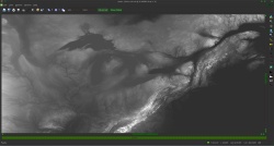
    For example, you could make your first sketch on an A4, or better a larger A3 sheet. I think it's easier to start by hand-drawing, but this is just my own opinion, you could start by software-drawing as well.

    Since your Great Lakes Earth is quite similar to the real Earth, I would suggest you to start with a simple outline of real Earth's coasts. An atlas as reference would help a lot your work. Then you could start modifying the coasts as per your written World's description.
    When you'll be satisfied with the Great Lakes Earth's coasts, you can pass to outline mountains and volcanoes, and so on.

    Little by little, you'll be surprised that you'll have in front of you a good world map. You bet!
    Last edited by AzurePlanet; 01-04-2016 at 01:30 PM.

  6. #6

    Default

    Quote Originally Posted by AzurePlanet View Post
    Since your Great Lakes Earth is quite similar to the real Earth, I would suggest you to start with a simple outline of real Earth's coasts. An atlas as reference would help a lot your work. Then you could start modifying the coasts as per your written World's description.
    When you'll be satisfied with the Great Lakes Earth's coasts, you can pass to outline mountains and volcanoes, and so on.

    Little by little, you'll be surprised that you'll have in front of you a good world map. You bet!

    Is there some interactive website where I can do just that?

  7. #7
    Guild Expert johnvanvliet's Avatar
    Join Date
    Jul 2012
    Location
    N 42.39 W 83.44
    Posts
    1,091
    Blog Entries
    4

    Default

    living in Michigan ( metro Detroit and Ann Arbor area )

    i post images of Mi. all the time
    i just posted one on imgur
    http://i.imgur.com/Bc4Hlgz.png

    -- 3d rendering


    Is there some interactive website where I can do just that?
    i would just start with the real DATA like the STRM or 30 meter data for the Earth and edit that

    the older strm used by BlueMarble
    ftp://mirrors.arsc.edu/nasa/topography/

    revised version 2.1 and 30 arc. sec.
    http://dds.cr.usgs.gov/srtm/version2_1/


    -- documentation for the data
    http://dds.cr.usgs.gov/srtm/version2_1/Documentation/
    Last edited by johnvanvliet; 01-04-2016 at 05:06 PM.
    --- 90 seconds to Midnight ---
    --------

    --- Penguin power!!! ---


  8. #8
    Guild Journeyer AzurePlanet's Avatar
    Join Date
    Dec 2012
    Location
    Italy, 43°28'N 11°09'E
    Posts
    178
    Blog Entries
    2

    Default

    Quote Originally Posted by Jdailey View Post
    Is there some interactive website where I can do just that?
    You could have a look at "Google My Maps".
    If you sign in, you can draw points, lines, and shapes over an Earth's background.
    Your maps are stored on Google Drive, then you can print them or save them as pdf, images or kml/kmz files.

    Here is an example I made for you: I drew that reddish coast line of Mediterranean Sea.

    Click image for larger version. 

Name:	Mappa di prova Linee costiere.jpg 
Views:	56 
Size:	654.7 KB 
ID:	78780
    Last edited by AzurePlanet; 01-04-2016 at 07:23 PM.

  9. #9

    Default

    There once was an article that can give me the power to see what the world might've looked if I raised the sea level, but for some reason, floodmaps.com is no longer open.

  10. #10
    Guild Journeyer AzurePlanet's Avatar
    Join Date
    Dec 2012
    Location
    Italy, 43°28'N 11°09'E
    Posts
    178
    Blog Entries
    2

    Default

    Quote Originally Posted by Jdailey View Post
    ...for some reason, floodmaps.com is no longer open.
    Don't worry. You can do it youself.

    There's a wonderful free software called "Wilbur" which can be used to make such things and lots more.

    1. You can download Wilbur here. And Wilbur tutorials too from the Tutorials Forum.
    2. You can grab those Earth heightfields suggested by johnvanvliet.
    3. You can get much better results than the following mine.

    Click image for larger version. 

Name:	GLE North America.jpg 
Views:	45 
Size:	84.9 KB 
ID:	78823 Click image for larger version. 

Name:	GL Africa.jpg 
Views:	31 
Size:	90.7 KB 
ID:	78824

Page 1 of 2 12 LastLast

Tags for this Thread

Posting Permissions

  • You may not post new threads
  • You may not post replies
  • You may not post attachments
  • You may not edit your posts
  •