Page 2 of 10 FirstFirst 123456 ... LastLast
Results 11 to 20 of 92

Thread: Ersïa

  1. #11
    Professional Artist ThomasR's Avatar
    Join Date
    Nov 2015
    Location
    Angers, France
    Posts
    4,153

    Default

    I have to concur, the flat projection is more appealing. As for the sea color, I'd go for a middle tone.

  2. #12

    Default

    By Zhar2
    My only critique would be to morph the topograpy a bit more in certain areas as some are recognisable as earth bound locations.
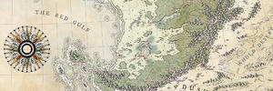
    Where do you find it too Earth-like? I've added some martian features, for fun and tests.

    By Daelin
    The relief is flawless, looks very crisp and scaled just right. How did you achieve that? Are they from some resource or done with an effect in Photoshop?
    Thanks, glad you like it . I still don't have Photoshop, and yes, it come from shaded relief maps of Earth... or Mars.

    By Thomrey
    I have to concur, the flat projection is more appealing. As for the sea color, I'd go for a middle tone.
    OK, one more vote, I'll probably keep the flat one then. Good call for the sea color.

    An updated version with mainly tests... As Daelin suggested, I'll probably redo the colors with more details and care later.
    Click image for larger version. 

Name:	Ersïa.jpg 
Views:	87 
Size:	1.31 MB 
ID:	88942

  3. #13
    Professional Artist ThomasR's Avatar
    Join Date
    Nov 2015
    Location
    Angers, France
    Posts
    4,153

    Default

    Now that you got a tablet, you should definitely play with the different blue tones in the water near the coast to get a more natural feel and get rid of the automatically generated lines

  4. #14
    Guild Expert DanielHasenbos's Avatar
    Join Date
    Mar 2015
    Location
    The Netherlands
    Posts
    1,623

    Default

    It's great to see you do another world map, I can't get enough of those! It's already shaping up nicely. Looking forward to see this develop.

    -Dan

  5. #15
    Guild Expert Eilathen's Avatar
    Join Date
    Aug 2007
    Location
    Kurald Liosan
    Posts
    1,336

    Default

    Cool stuff, Ilanthar. Thanks for showing us the flat projection. I think it looks awesome.

    And good to hear about the Dohmantyr work...hope you'll continue on it and show it to us. Or as i said, make another map in that same style
    I'm trapped in Darkness,
    Still I reach out for the Stars

  6. #16
    Guild Journeyer Eld's Avatar
    Join Date
    Feb 2013
    Location
    Germany
    Posts
    112

    Default

    I do also prefer a middle ton for the sea color. The northeastern continent looks to me like having the relief of the Himalaja and nearby mountain ranges. I wonder if that's too obvious and if this shape makes sense?

  7. #17

    Default

    By Thomrey
    Now that you got a tablet, you should definitely play with the different blue tones in the water near the coast to get a more natural feel and get rid of the automatically generated lines
    Ehrr... Yup, I guess I could try. I'm a bit afraid of a clash of styles I must say.

    By DanielHasensbos
    It's great to see you do another world map, I can't get enough of those! It's already shaping up nicely. Looking forward to see this develop.
    Thanks a lot Daniel!

    By Eilathen
    And good to hear about the Dohmantyr work...hope you'll continue on it and show it to us. Or as i said, make another map in that same style
    You're welcome for the flat projection. I worked the land shapes this way, so I suppose it makes sens it looks better... About Domhantyr, I actually began a regional map of Hasvatra (north east of the world map) in the style of the Western Torfani map. But I haven't worked on it for months.

    By Eld
    I do also prefer a middle ton for the sea color. The northeastern continent looks to me like having the relief of the Himalaja and nearby mountain ranges. I wonder if that's too obvious and if this shape makes sense?
    I'll certainly keep this general color for the seas. And, the northeastern continent is actually done with a lot of different mountains, and only very small parts of himalayas . A lot of it is coming from Iran/Afghanistan/Pakistan regions. What do you mean about the shape making sense?
    Btw, I used the Himalayas mainly on the southeastern continent.

    Update. I'm not completely satisfied with the topography and still have corrections/changes to do. When it's gonna be done, I'll rework the colors more precisely and with more diversity (it's more general placeholders right now). I may do other tests in between.
    Click image for larger version. 

Name:	Ersïa.jpg 
Views:	83 
Size:	1.33 MB 
ID:	88972

  8. #18
    Professional Artist ThomasR's Avatar
    Join Date
    Nov 2015
    Location
    Angers, France
    Posts
    4,153

    Default

    True ... my bad

  9. #19
    Guild Artisan Warlin's Avatar
    Join Date
    Oct 2015
    Location
    Montpellier (France)
    Posts
    620

    Default

    Nice work Ilanthar. The shading relief and your coloration of the land mass work well together. To be completely honest, I think that the placement of your relief is not in agreement with the tectonic plates, but this has little importance in the light of the work done. Waiting to see your worldbuilding stuff .

  10. #20

    Default

    By Warlin
    Nice work Ilanthar. The shading relief and your coloration of the land mass work well together. To be completely honest, I think that the placement of your relief is not in agreement with the tectonic plates, but this has little importance in the light of the work done. Waiting to see your worldbuilding stuff.
    Merci ! Could precise how you would see the relief? It's supposed to be a weird world, but I'm curious and could redo the topo.
    As for the worldbuilding stuff... I'm working on the dominant lingo and a list of countries right now.

Page 2 of 10 FirstFirst 123456 ... LastLast

Tags for this Thread

Posting Permissions

  • You may not post new threads
  • You may not post replies
  • You may not post attachments
  • You may not edit your posts
  •