Reply With Quote
Thanks for the compliments on the skull. Unfortunately I can't stand that it has a mathematical / placement error that isn't immediately obvious, but that I can't miss when I see it.


still looking good, love that skull .. that's just a great lair
regs tilt
:: My DnD page Encounter Depot free stuff for your game :: My work page Catapult ::
:: Finished Maps :: Competion maps - The Island of Dr. Rorshach ::
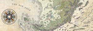
:: FREE Tiles - Compasses :: Other Taking a commision - Copyright & Creative Commons ::
Works under CC licence unless mentioned otherwise
Thanks for the compliments on the skull. Unfortunately I can't stand that it has a mathematical / placement error that isn't immediately obvious, but that I can't miss when I see it.
Dyson's Dodecahedron
an RPG blog, with a few maps
Pretty much all my maps are drawn by hand - ink on paper - and then scanned and contrast-enhanced
#Inktober2017 - Map 13 - "Teeming"
Since the Day of the Green Sun three weeks ago, the catacombs of Olik Gullar have been teeming with the undead. A sanctified necropolis, Olik Gullar contains untold numbers of the dead from the city above. The catacombs have been locked down now, but some worry that it is only a matter of time before the restless dead claw their way through to the cobbled streets of the city proper...
This map is a "proof of concept" of what I wanted a previous catacomb & sewer map to look like. I just didn't have the skill at the time to pull it off. This will still require some amount of post-production to make it more legible - moving the closeup of Section A further up to make space between it and the catacombs, and making a bit more room between the closeups of sections E & G. Basically a full reshuffling of the closeups can be done in order to make the map easier to layout and parse.

Dyson's Dodecahedron
an RPG blog, with a few maps
Pretty much all my maps are drawn by hand - ink on paper - and then scanned and contrast-enhanced
#Inktober2017 - Map 14 - "Fierce"
The Manticore Peninsula wasn't named at random. Many explorers of the region looking for the ancient temples and treasures of the Tauvec have encountered the fierce beasts. The Manticores' Teeth is a cavern on a cliff face that peeks out over Hadrow's Woods where a small family of manticores are known to roost. The cavern is or particular note because of the two natural-looking pillars of stone that cut across the entrance (thus the "teeth").
The cave beyond isn't actually a natural cave, but an old Tauvec temple of the Lord who Listens to the Winds. The lower entrance to the temple has been completely covered by scree that has fallen from the cliff face, making the upper gallery the only viable entrance - which is of course the home of three manticores.

Dyson's Dodecahedron
an RPG blog, with a few maps
Pretty much all my maps are drawn by hand - ink on paper - and then scanned and contrast-enhanced
And I'm caught up!
#Inktober2017 - Map 15 - "Mysterious"
The eight stones loom around Prior's Hill. Grasses never grow tall here, and the druids' paths lead here according to those willing to track their travels through the forest.
On the right nights, with the right rituals, you can open the portal on Prior's Hill and climb down the stairs to the black dungeons below.

Dyson's Dodecahedron
an RPG blog, with a few maps
Pretty much all my maps are drawn by hand - ink on paper - and then scanned and contrast-enhanced
#Inktober2017 - Map 16 - "Fat"
I'm not sure how my pens wandered from the prompt of "Fat" to drawing what is distinctly an alternate Village of Hommlet, but I try not to second guess them and will instead write up a connection after the fact. Like this:
Rosnar Hill is named after the first mayor of the small settlement, who's family still owns the inn at the crossroads bridge. The settlement is home to Lord Veleydem who owns the small stone tower on the hill and who tries to make himself important to the Cities of the Lords by keeping a close eye on Satrapy merchants and others travelling along this border region. Most think of Veleydem as a bloated parasite, a massive man of not insignificant girth and appetite. However, he is actually quite clever and significantly more skilled than most would believe as he hides his history as a successful adventurer in his youth who has decided to settle here, spend his money quietly on good food, and still keep an eye on things for the Cities of the Lords where he was born.

Dyson's Dodecahedron
an RPG blog, with a few maps
Pretty much all my maps are drawn by hand - ink on paper - and then scanned and contrast-enhanced
#Inktober2017 - Map 17 - "Graceful"
I don't think the "grace" really came through at all - in the end this became a practice session for crunchy crumbly isometric stone ruins.
The Pillars to the Temple of Rains
At the edge of the Falleck Promontory overlooking the Dry Badlands of Korush, a series of bizarre (and probably unnatural) stone pillars reach 60 feet up from the dry floor of the land and support a series of small bridges that in turn lead to the ruins of the Temple of Rains. Some say rebuilding the temple will bring water back to the badlands, but most believe the temple was built here in the first place because water is so rare.

Dyson's Dodecahedron
an RPG blog, with a few maps
Pretty much all my maps are drawn by hand - ink on paper - and then scanned and contrast-enhanced
#Inktober2017 - Map 18 - "Filthy"
Since I had just released my redraw of the Dungeon! boargame map today via my blog, I decided that the obvious choice for "Filthy" (sewers) should combine with the Dungeon! map into something more. So here we have the underdungeon that is connected by a number of grates to the chambers above.
Right in the middle we have the upper drainage area, linked to the Main Gallery above (and designed to keep the rest of the dungeon from flooding from rains above by moving the water down beneath the corridors as soon as it reaches the bottom of the gallery stairs). The water flow continues down to chambers underneath the guardroom (where the water generally gets... less pleasant) and then to the kitchens. A long run brings the waterflow to the torture chamber where it picks up whatever is washed out of that chamber and brings it down to the Queen's Treasure Room Annex which in at least one more recent edition of the boardgame is illustrated with a large hole in the centre - this is where the resident Otyugh lives and leaps up to try to snack on adventurers in the treasure chambers. It then flows down beneath the king's chambers (but is not connected to those chambers where it meets the flow from the wizard's laboratory before flowing out to the river outside.
On the northeast side we have the ghouls' runs, a set of corridors dug out by the ghouls and other foul creatures living beneath the north side level 4 crypts.
(All the grates in this map are actually the grates set in the floors above when mixed with the classic Dungeon! map - there's also a small stair error in the ghoul crypts that has to be reversed when I finally scan this for release)

Dyson's Dodecahedron
an RPG blog, with a few maps
Pretty much all my maps are drawn by hand - ink on paper - and then scanned and contrast-enhanced
I like the messiness of it
#Inktober2017 - Map 19 - "Cloud"
ThunderHead is one of the rare cities on the elemental plane of air, near a boundary of the plane of water. It has become home to many expats from the Prime who have found themselves here - crime is low, magic is plentiful, and the birdwatchers find the place incredible.

Dyson's Dodecahedron
an RPG blog, with a few maps
Pretty much all my maps are drawn by hand - ink on paper - and then scanned and contrast-enhanced
 Posting Permissions