

 Reply With Quote


Interesting project, I doubt u can get better distortion correction due to the fact that the map itself is not a precise satellite data map with some parts interpretated , but overall is looking good.


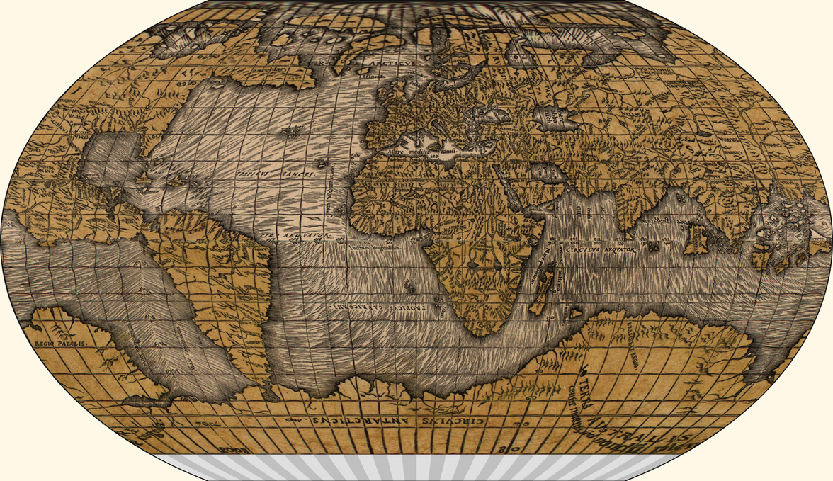
A friend suggested I come here to post this. I've been working on re-projecting this map to a more commonly-seen map projection. Specifically, I've been editing it one 10°×10° section at a time, and using a perspective correction tool to adjust it to an oblong, which I then resize/reshape to a square and paste into a section of a plate careé map. After that, I use g.projector to change it to my preferred presentation map projection (Kavraiskiy-VII).
This is clearly not ideal, as it pretends each 10°×10° section is a flat plane, when in reality it's a segment of a sphere. The distortion is particularly noticeable in the extreme poles and in the equatorial region around where this map has its Far East/Caribbean area. One solution I thought I had was to lay out a series of grid reference points by using g.projector to draw a grid in Oronce's map projection that I could then overlay onto the original, and use that (with a finer graticule than what is in the original). This wouldn't eliminate the distortion, but would reduce it. However, it seems that either my guess as to his projection (Bonne, interrupted at the equator) was wrong, or he drew it badly; either way, that approach to fixing the problem doesn't seem viable. Is there a better way to correct the distortion?

Last edited by Ashtagon; 02-24-2018 at 09:50 AM.
Interesting project, I doubt u can get better distortion correction due to the fact that the map itself is not a precise satellite data map with some parts interpretated , but overall is looking good.
To do the pole, I crop an area around the pole, fitted the crop to make a tangent around the 80° mark, resized that crop so it would be a perfect square, then used the polar coordinates tool to transform it. I then cropped each 10° wide section and pasted it individually. The initial approach was to resize it as a single long strip to be pasted into the master file, but that turned out not to work, as the longitude lines are not drawn perfectly.

Completed at last:
https://ashtagon.deviantart.com/art/...cted-733489675 (click through for high-res version)
Awesome work .
 Posting Permissions